Saturday 30th March to Saturday 6th April – Tasmania
We had a week to explore ‘Tassie’, a hire car and a rough idea that we wanted to do a circuit of the island with some hiking in the National Parks. Our flight arrived at Hobart in the evening, we had booked an airbnb for the first night and would play it by ear as we went along. What could possibly go wrong? And nothing did (apart from a punctured tyre which caused a delay of a few hours as we got it repaired). We loved Tasmania. Beautiful scenery, wonderful hiking, mountains, rivers, lakes, forests, little towns, friendly people… and above all it was sunny but not too hot. We saw wombats, a few live wallabies (which hopped away before we could get a photo) and also, sadly, a lot of dead wallabies and other wildlife by the roadside. We aimed to avoid driving at night after Hugh hit a small creature having been blinded by the lights of an oncoming car – very distressing.
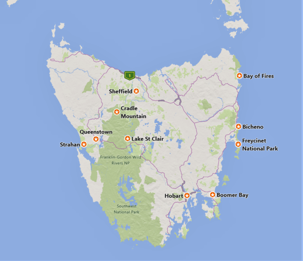
Day 1 Hobart to Freycinet National Park
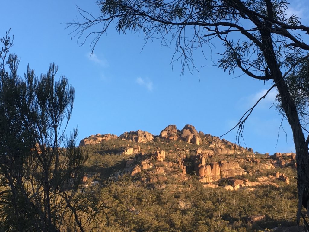
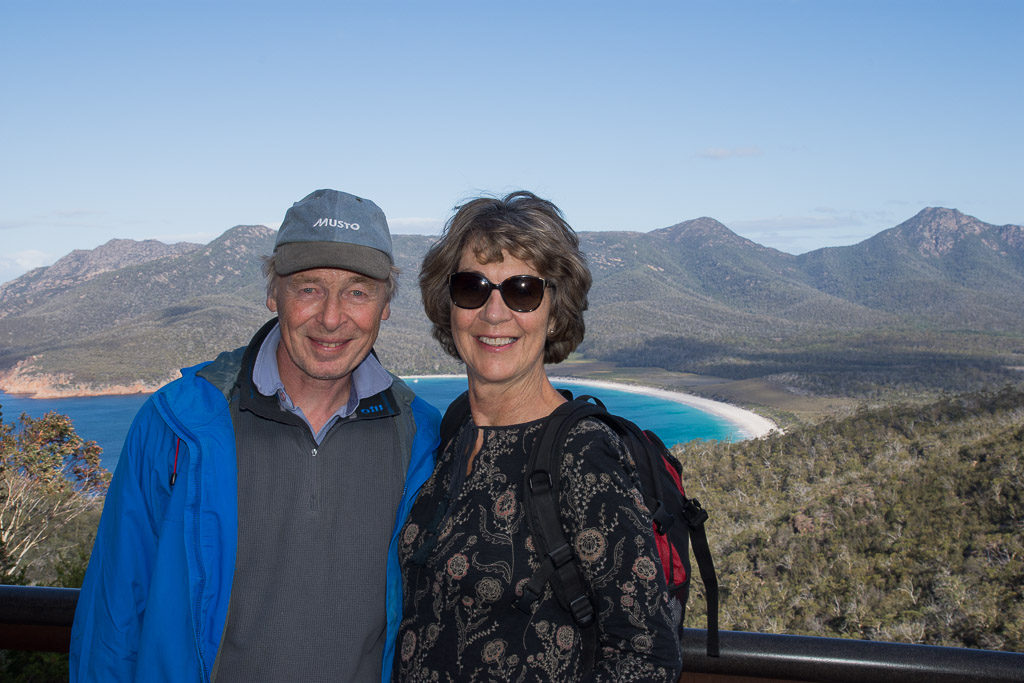
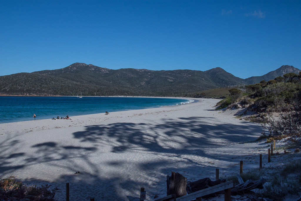
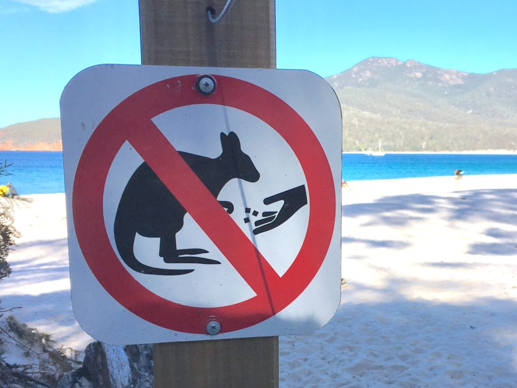
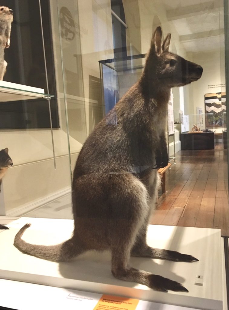
After a leisurely breakfast chatting to our hosts in the airbnb we headed north along the East Coast Highway to Freycinet National Park. In the car park a small wallaby came up to say hello but hopped away before I had a chance to get my camera. Little did I know this would be my last opportunity to have photographed one. Although it was 3pm we were keen to do the 11km circular walk. For the first part of the route, up to Wineglass Bay Lookout with its spectacular rock formations and down to the silver sand beach, there were parties of other tourists. After that we were alone as we took the path through the bush with light filtering down through tall gum trees and vibrant bird song, across to Hazard Bay and then back along the rocky coast. We saw a few wallabies as they bounded away into the bush.
We arrived back at the car park at dusk and drove on to the small holiday town of Bicheno where we eventually found the isolated Airbnb, down a dark country lane and by the beach. By the time we got back into Bicheno everywhere was closing, even the pub though they sold us beer, crisps and chocolate which we ate in bed watching Michael MacIntire on TV.
Day 2 – Bay of Fires (plus a punctured tyre) to Sheffield
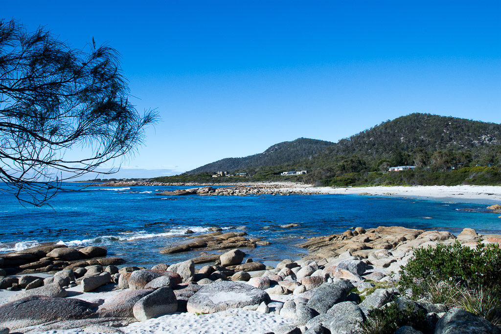
The Bay of Fires, a 100km drive north from Bicheno, was named by Captain Tobias Furneaux in 1773 as he sailed along the coast in his ship HMS Adventure and saw the fires of Aboriginal people on the beach. It is a beautiful region on the northeastern coast with white sandy beaches, clear blue water and orange-hued granite boulders, the orange colouring on the rock due to a lichen.
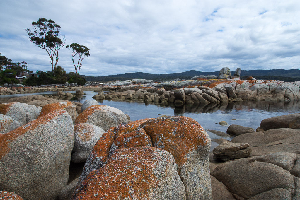
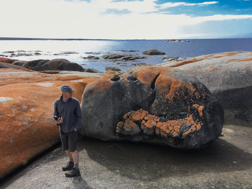
At the northern end of the 50km long Bay of Fires the unmade road finally comes to an end and beyond is national park. Here is a place called The Gardens where you can scramble over the orange-red rocks to a windy viewpoint over the bay. Returning to the car we found we had a flat tyre, as did four other cars in the car park, probably due to the roadworks we’d passed through earlier. Our spare tyre was pretty flat too but it got us back to St Helens where we joined the queue at the tyre place to get our puncture repaired.
Despite the late hour we took the more scenic but windier and slower northern road heading west, a spectacular drive through forest and National Parks, passing a few small towns and to Launceston, Tasmania’s second largest city, then on to Sheffield, arriving well after dark.
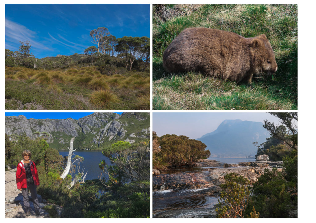
Day 3 Sheffield & Cradle Mountain
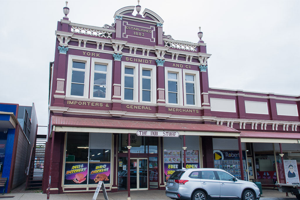
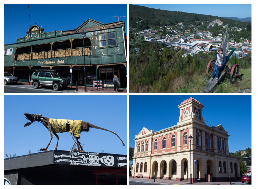
Sheffield is a small, rural town which was best known for its butterfat production and dairy farming and was becoming increasingly rundown until it reinvented itself as Mural Capital of Australia. There are now over 60 murals depicting the history of the area plus several art galleries and the annual Tasmanian Medieval Festival with those ancient Australian sports of fencing, archery and jousting which all attract tourism to the town.
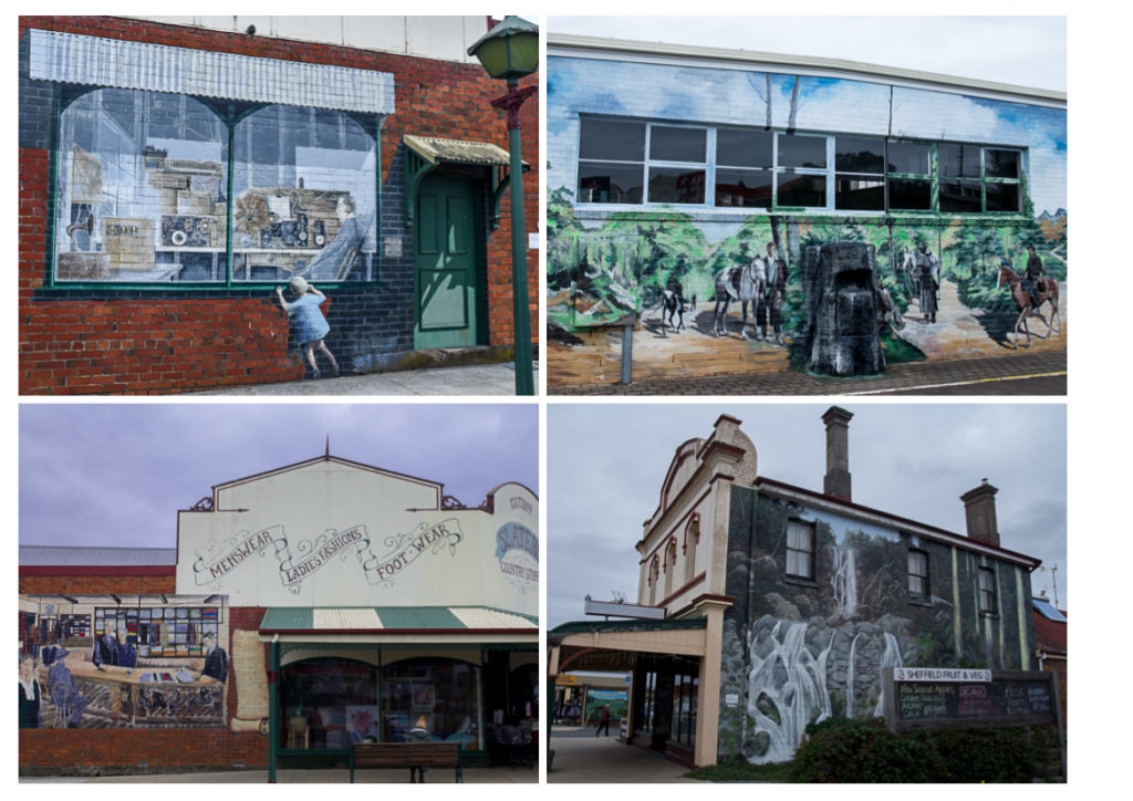
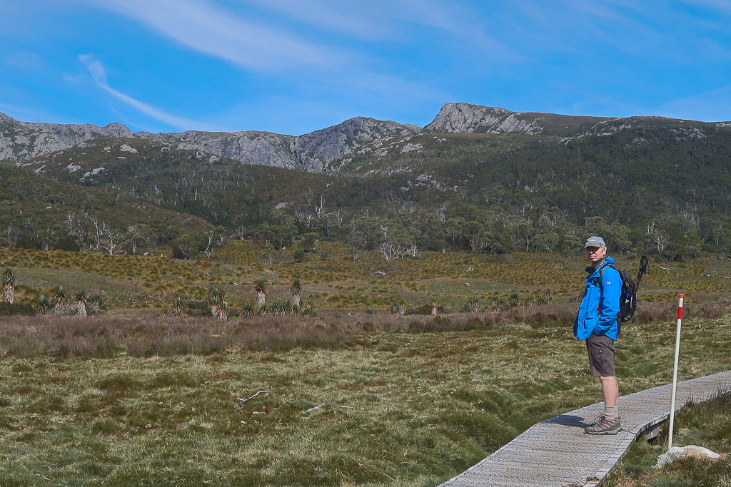
We only had time to admire a few of of the murals as we were on our way to the Cradle Mountain-Lake St Clair National Park. To help preserve the environment cars are left in a large car park at the visitors centre then a shuttle bus takes you into the National Park where there are various walks, from a short stroll around Dove Lake to longer distance trails and a six-day trek to Lake St Clair. We started at Ronny’s Creek along a boardwalk through alpine grassland, with wombats nonchalantly munching on clumps of grass along the way. The path climbed up through rainforest, past Crater Falls and higher, to Crater Lake then further up into a more open, rugged landscape to Marion’s Lookout with a view to Cradle Mountain, Tasmania’s sixth highest peak.
On the way back down to Dove Lake we got chatting to a large group of young people from Tonga and Vanuatu, who were in Tasmania for six months fruit picking, as the South Pacific Islanders often do. They seemed happy to be earning money doing the work but reticent to discuss what conditions were really like for them working over here.
That night we had booked a room in the Strahan Wilderness Lodge (rather dated and not nearly as romantic as it sounds) on the outskirts of the west coast town of Strahan. The drive there took us initially through forested countryside into a region scarred by mines and quarrying. As we approached Strahan it was getting dark and, momentarily blinded by the light of an oncoming car, we hit a possum. Very upsetting.
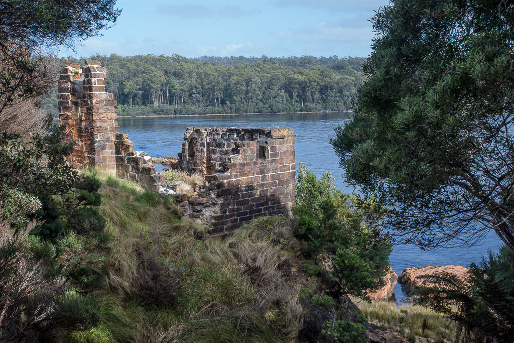
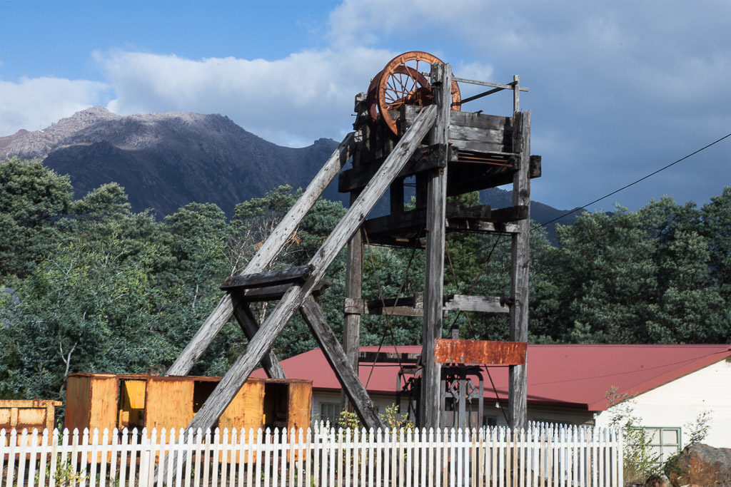
Day 4 – Gordon River & Sarah Island ( a notorious penal settlement) to Queenstown
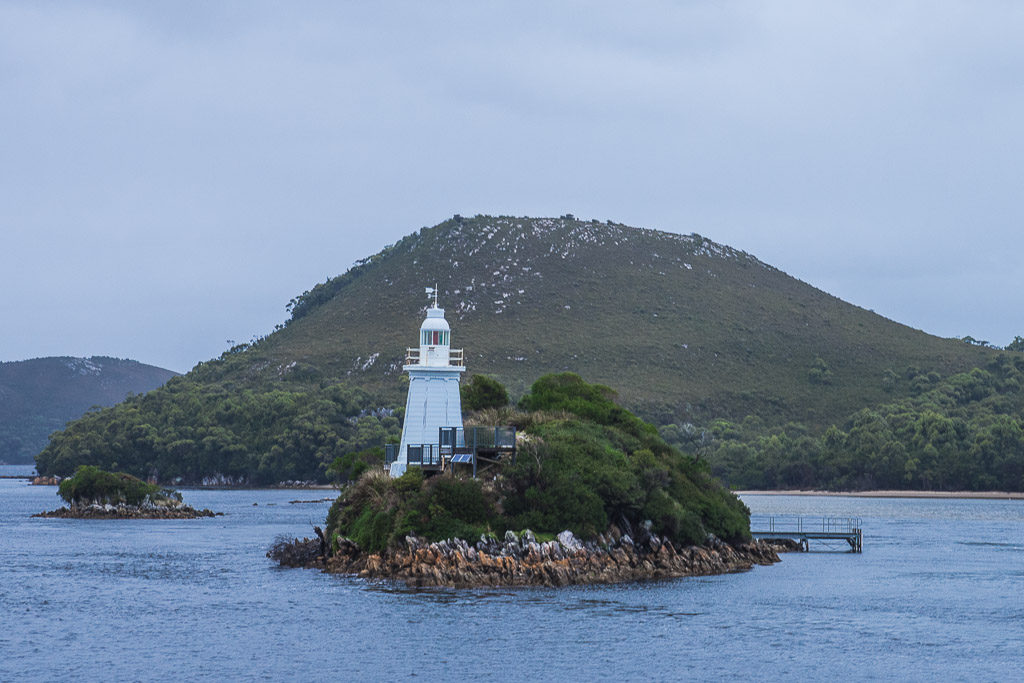
Strahan was originally developed as a port serving the mining settlements and the timber industry in the area although it is now mainly a tourist town. It is situated on Macquarie Harbour, a large inlet which has a narrow entrance from the sea known as Hell’s Gates from the time when convicts were shipped here to Sarah Island, a notorious and particularly harsh British colonial penal settlement in the early 19th century, from which there was little chance of escape. We joined a boat excursion around Macquarie Harbour, briefly out to sea through Hell’s Gates, back in and to Sarah Island then up the Gordon River which empties into Macquarie Harbour.
Beyond here lies a huge, remote area of Tasmanian wilderness, the Franklin-Gordon Wild Rivers National Park with dramatic mountain peaks, eucalyptus forest and temperate rainforest dissected by the Gordon and Franklin Rivers and their tributaries. This area was threatened by the proposed damming of the Gordon River in the 1980’s which fortunately was shelved after massive opposition. Felling of the ancient and slow-growing Huon Pines was banned in the 1970’s but not until many had been cut down for their timber which resists rotting and so was particularly prized for boat building. These trees, which only grow in the wet, temperate rainforests of South West Tasmania, are some of the oldest living organisms on the Earth and can grow to a height of 30 meters with some individual live specimens found which have been aged at over 2,000 years. I bought Hugh a cheese knife, its handle made from old, salvaged Huon Pine so we have our own piece of ancient rainforest.
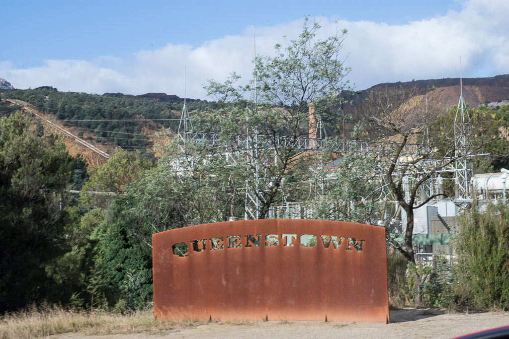
From Strahan a short drive to the mining town of Queenstown, a meal in the faded grandeur of the Imperial Hotel and a night in another Airbnb, the home of a young local couple.
Day 5 – Queenstown, Lake St Clair to Hobart
We had time for a quick look round Queenstown and a walk up to the viewpoint at Spion Kop overlooking the mining town, which commemorates the local soldiers who died in an eponymous battle in the Boer War.
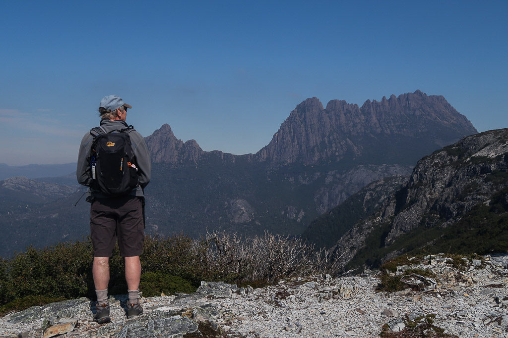
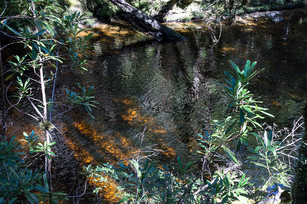
Time too to walk up to look out at Horsetail Falls above Queenstown before driving east along a winding road through natural forests stopping for another walk through the lush, temperate rainforest, with trees stretching high above as they competed the reach the light and mosses covering fallen tree trunks, to the meeting of the Franklin and Surprise Rivers.
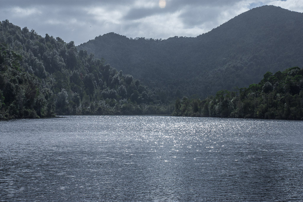
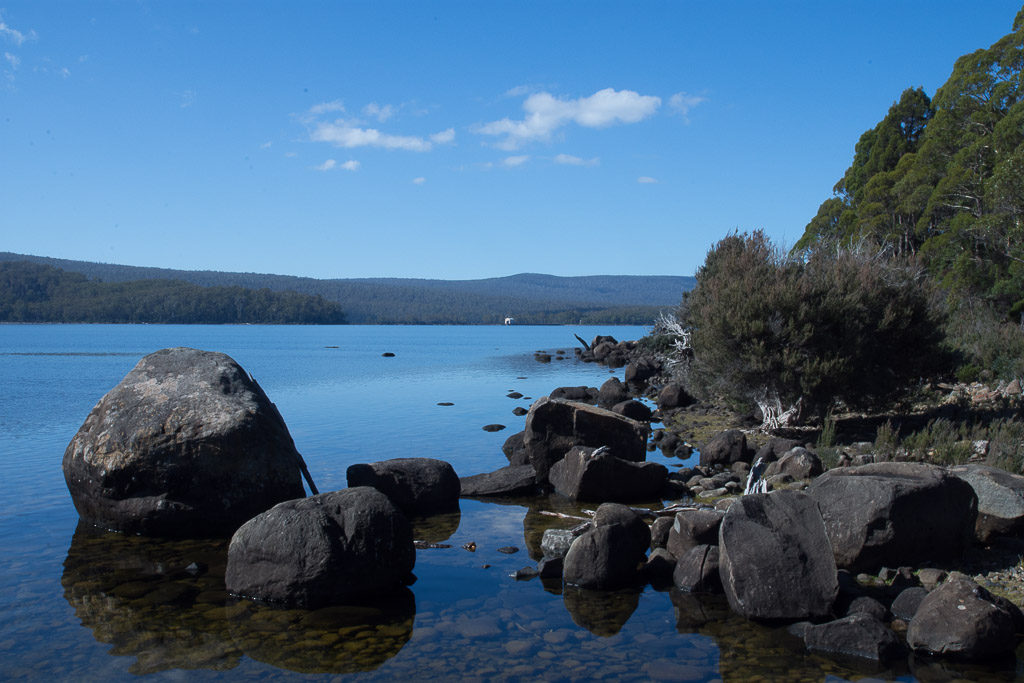
The road passed near to Lake St Clair, a huge, still, peaceful body of water with more potential walks…..
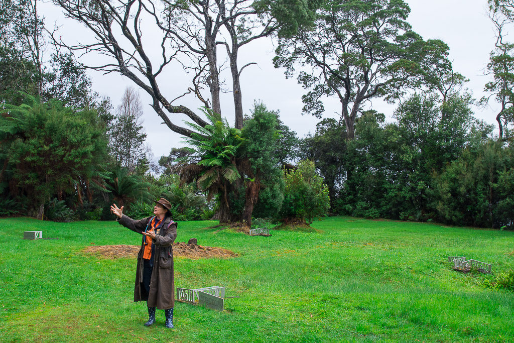
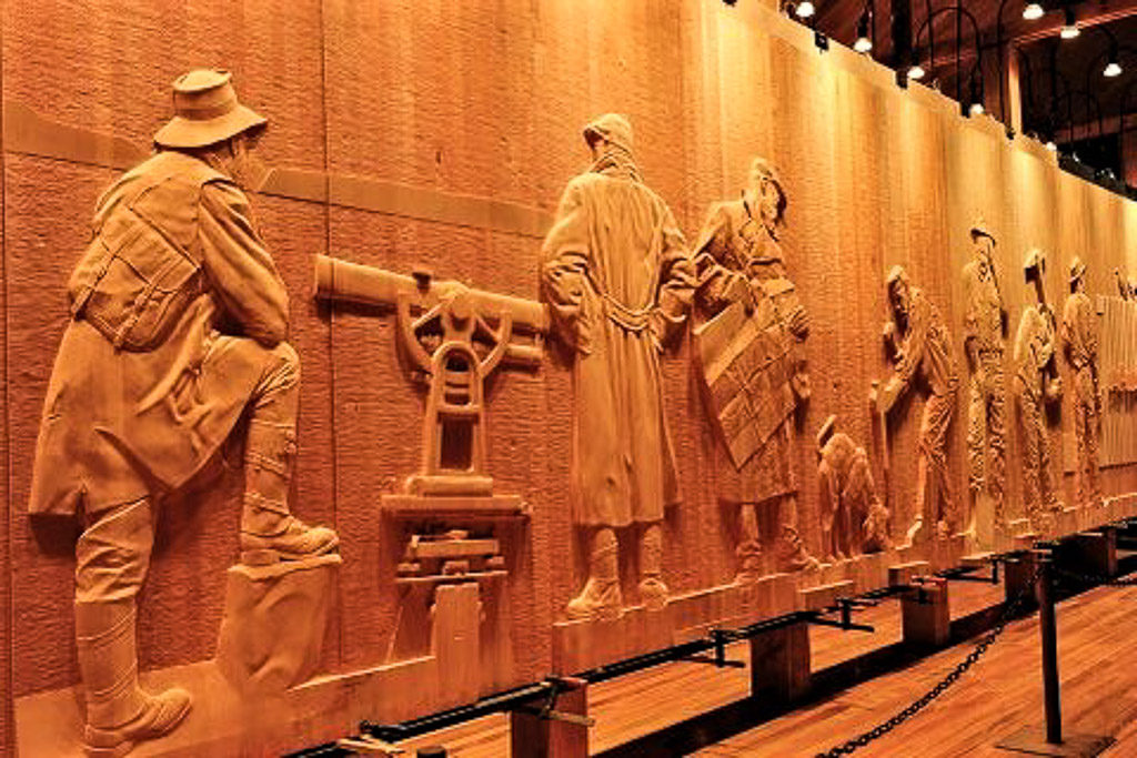
…….but after lunch at the visitor centre we continued on to see The Wall in the Wilderness. This is a work in progress which will ultimately be a 100 metre long frieze of 3 metre high carved wooden panels by Australian artist Greg Duncan showing the life of the early Australian settlers. It was impressive and somehow reminiscent of the Elgin Marbles in scale, but mainly seemed a celebration of macho Australian manhood although it also illustrated the extinction of various animal species such as the Tasmanian Tiger. Photography was not allowed so I’ve borrowed a photo from the web.
And so back to Hobart and beyond to Boomer Bay and we had completed our circular trip around Tasmania. This night we spent at Phoenix Farm, so named as it had been rebuilt after being twice destroyed by bush fires. Owned by Michael, a professional chef, we enjoyed a superb supper of lamb with a glass of excellent Pinot Noir and highly entertaining conversation with our host.
Day 6 – Hobart
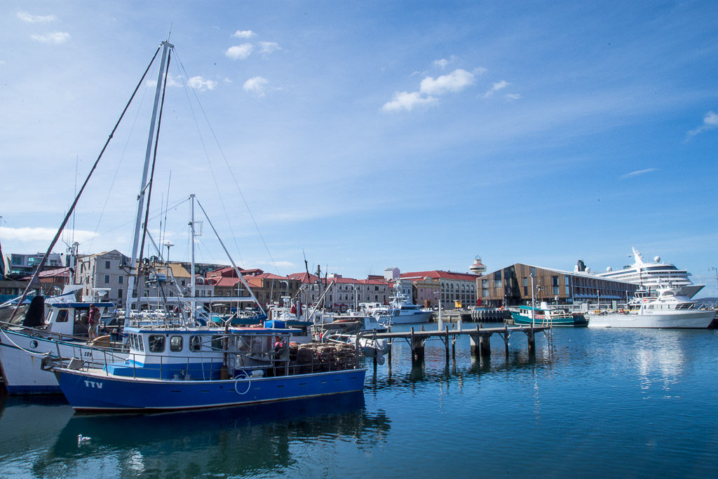
We had planned to visit the nearby former penal colony at Port Arthur but decided to spend our last day in Hobart, drinking coffee and wandering around the waterfront…….
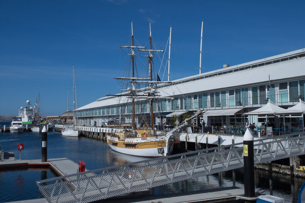
…. with a visit to the Tasmanian Museum and Art Gallery where I was finally able to photograph a wallaby.
Tasmanian tigers, we learnt, were hunted to extinction in the wild, the last one dying in captivity in 1936 just two months after it was declared a protected species. The indigenous Tasmanians didn’t fare well either after European colonisation with their numbers reduced by disease, effective enslavement, slaughter and incarceration in camps, with the last full-blooded Tasmanian Aborigine dying in 1876.
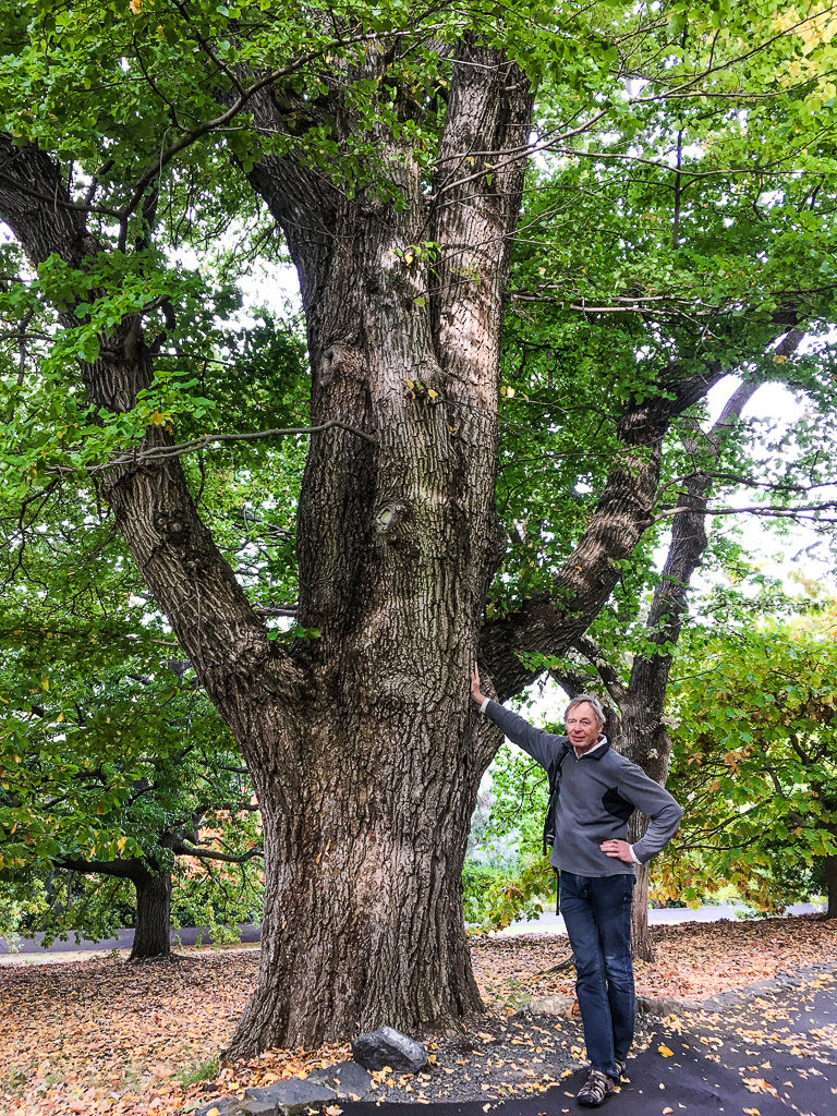
In the Botanical Gardens Hugh was thrilled to find a mature English elm tree which used to be a feature of the English landscape until they were killed off by Dutch elm disease in the 1970s and ‘80s.
Although we fitted in a lot in our week in Tasmania there was still more we’d have loved to have seen and done and we wish we’d stayed another week.. or even two.
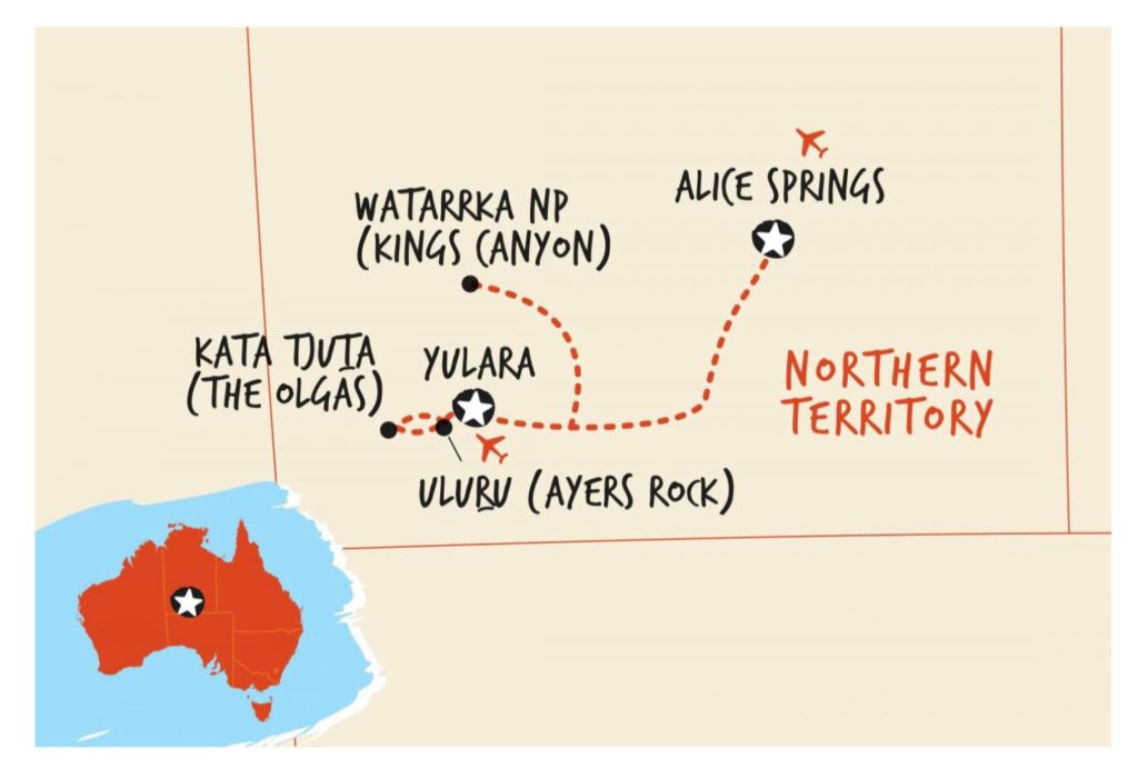
Saturday 6th to Thursday 11th April – Uluru-Kata Tjuta National Park, Kings Canyon to Alice Springs
From Hobart it was an early morning flight, changing in Sydney, to Ayers Rock airport. Flying for hours over the brown and barren-looking landscape below, criss-crossed by dead straight roads and with the occasional dry salt lake, started to give some idea of just how huge Australia is. As the plane circled to land we could see the rock, Uluru, rising out of the flat land.
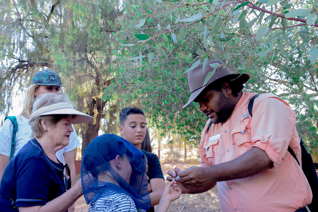
Stepping off the plane it was hot, about 32deg C, but a dry heat which is much more tolerable that the wall of humid heat you often get in tropical climates. Yulara (Ayers Rock Resort) is the only place where you can stay around here apart from a campground, and accommodation ranges from expensive to cripplingly expensive. I had booked a room at the cheapest hotel which, at £180 a night, made Hong Kong prices seem reasonable. Still, it was comfortable and had air conditioning. There are four hotels here and a town square with tourist shops, art galleries selling indigenous crafts and paintings, cafes and a supermarket – a place oriented around tourism. We joined a garden tour with a local indigenous guide explaining the use of plants and trees as foods and medicines for the Aboriginal people, and a talk about of their way of life and the weapons they used to hunt.
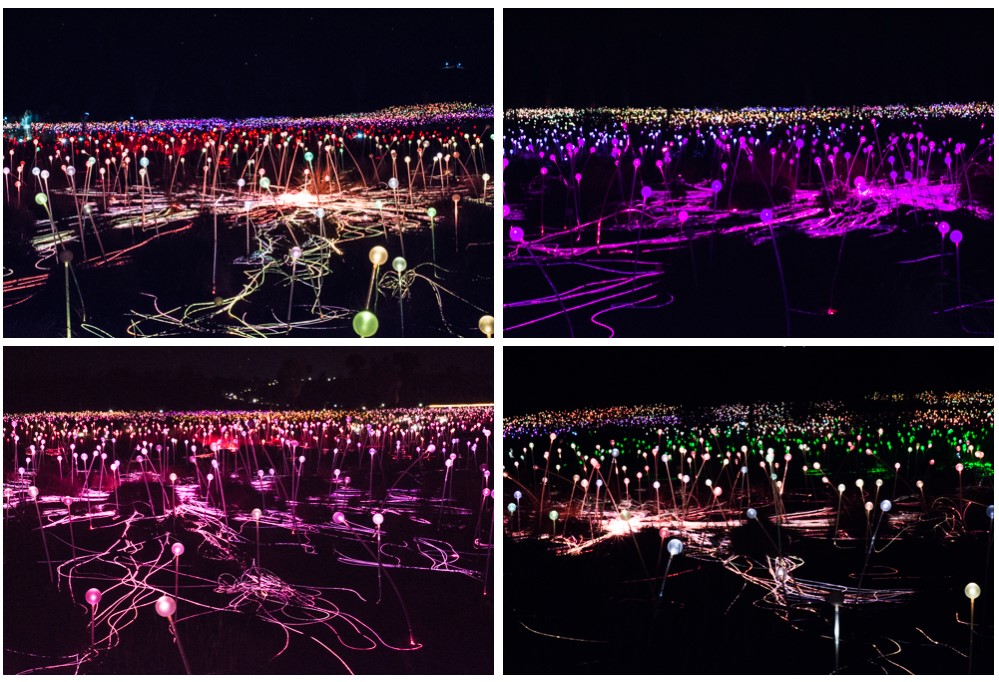
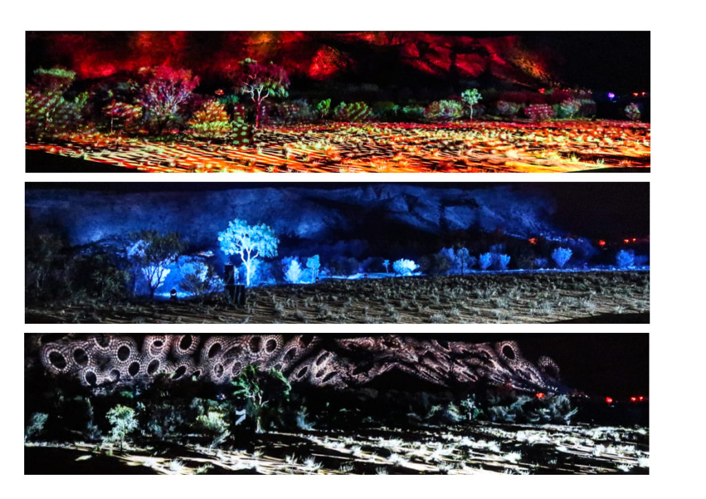
That night we had booked to see the ‘Field of Light’, an art installation in the desert ‘a fantasy garden of 50,000 spindles of light, stems breathing and swaying through a sympathetic desert spectrum of ochre, deep violet, blue and gentle white’. An impressive display over many acres with paths wending their way through the light fields, and the inspiration and creation of English artist, Bruce Munro.
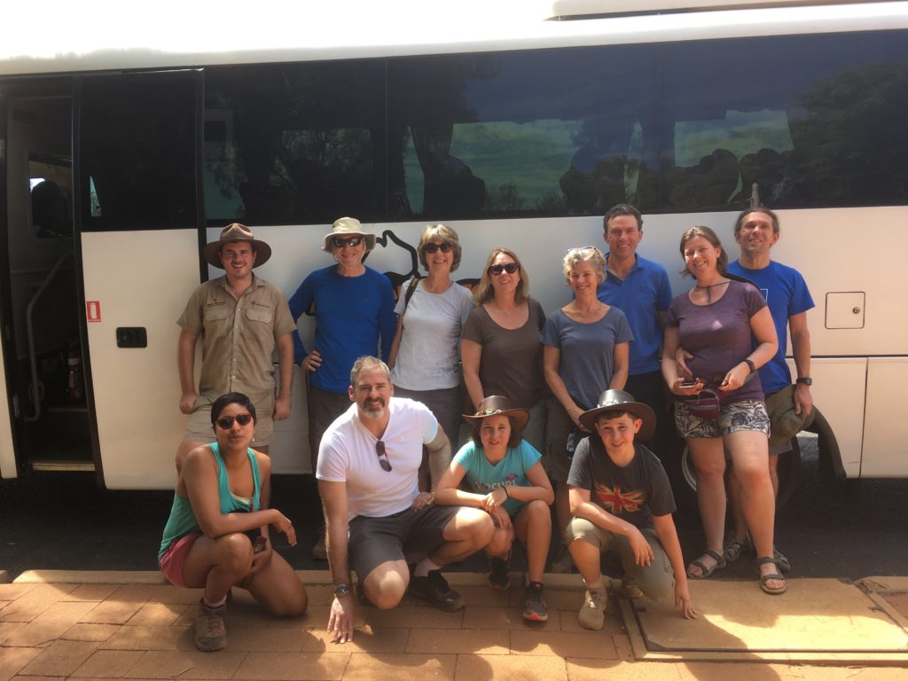
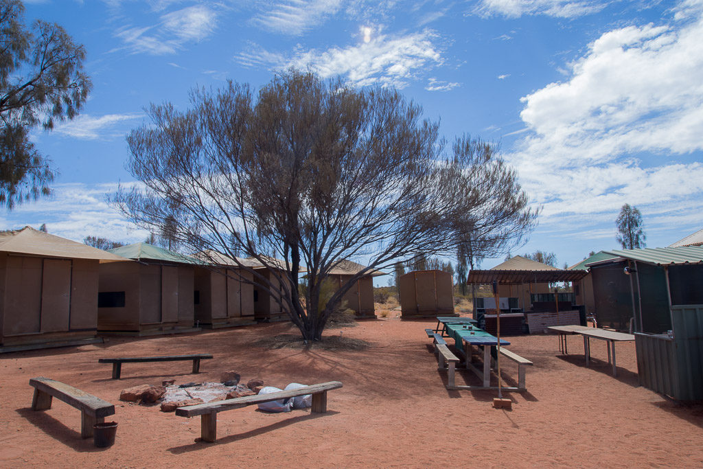
Adventure Tours offered one up from the basic backpackers trip, camping in rigid ‘tents’ with a fan, framed beds, mattresses, pillows and bedlinen, three meals a day, wine with evening meals and a bus with air conditioning. Eight of the other nine members of our group turned out to be English (two other couples and a family of four) with an Indian doctor who had been working in New York and Australian tour guide/driver Phil and cook Becks.
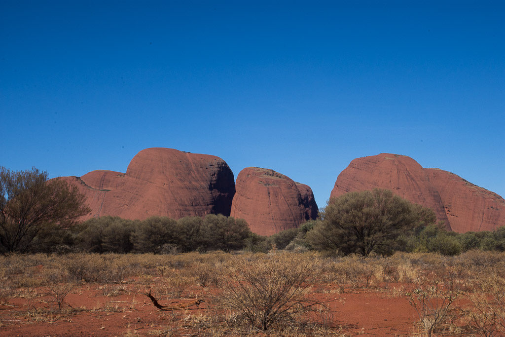
Our first stop was Kata Tjuta, an Aboriginal name meaning ‘many heads’, also known as the Olgas, a group of 36 large, domed rock formations which are sacred to the Aboriginal people and are home to ‘spirit energy from the Dreaming’. We were able to walk into a gorge between two great rocks which, in the afternoon light, glowed a warm orange. We were glad of our flynets as the flies descended, irritatingly buzzing around face, eyes and mouth.
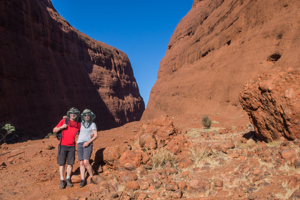
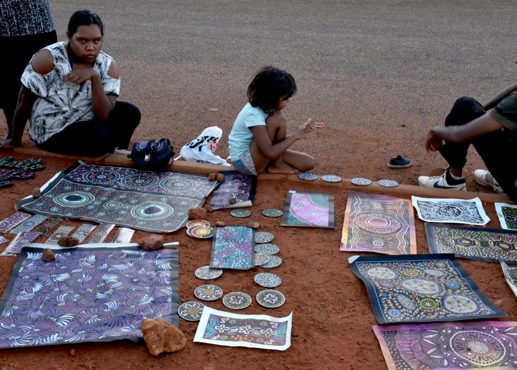
We joined other tour buses to view Uluru at sunset. Some local women were displaying their dot paintings, the abstract designs representing different aboriginal symbols, and we bought a small one for $70. Much larger works can sell in shops and galleries for several thousand dollars.
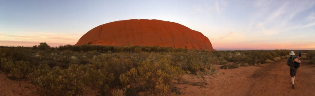
Back at camp supper was beef and kangaroo (not dissimilar to beef but slightly more gamey) with a vegetarian alternative for Hugh, still resolutely maintaining his no beef campaign. A 5am start for breakfast then on to see Uluru silhouetted at dawn as the sky changed from black to blue through hues of red and yellow.
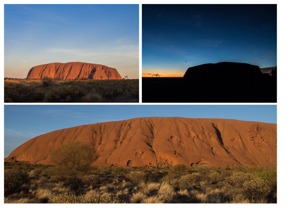
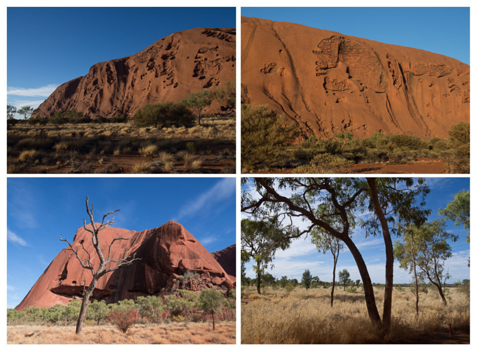
As we walked around the base of the huge rock its colours became more intense, red and orange.
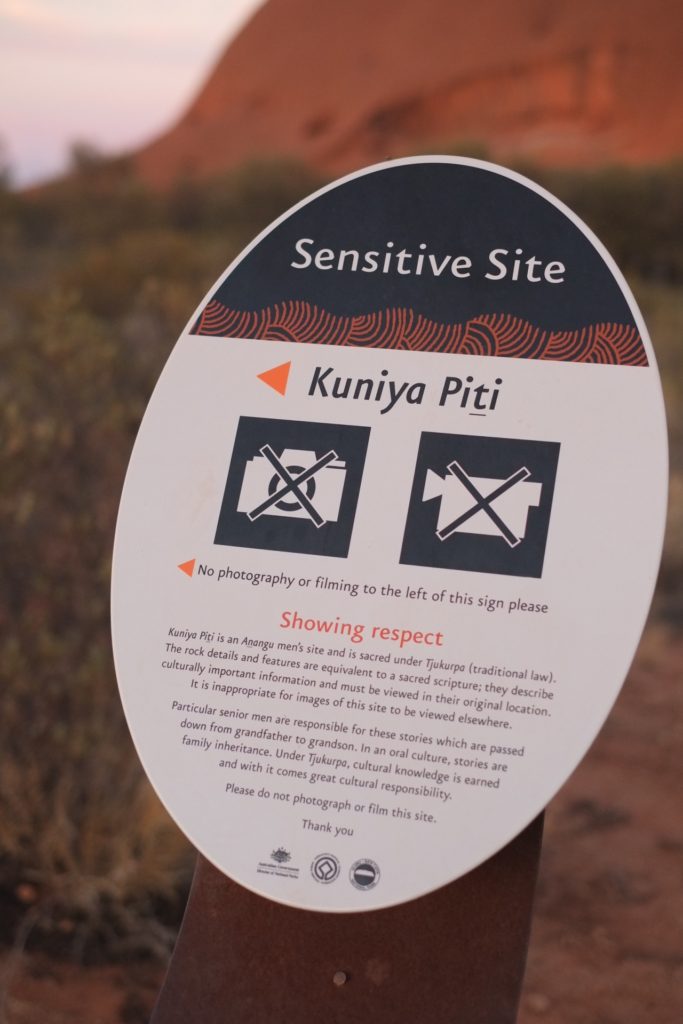
There are signs up advising which parts of the rock have special spiritual significance for the Anangu people who own the land and you are requested not to photograph here.
What I hadn’t imagined is that Uluru is not smooth but is covered with cracks and fissures and we had fun making out shapes of animals and skulls in the patterns they make.
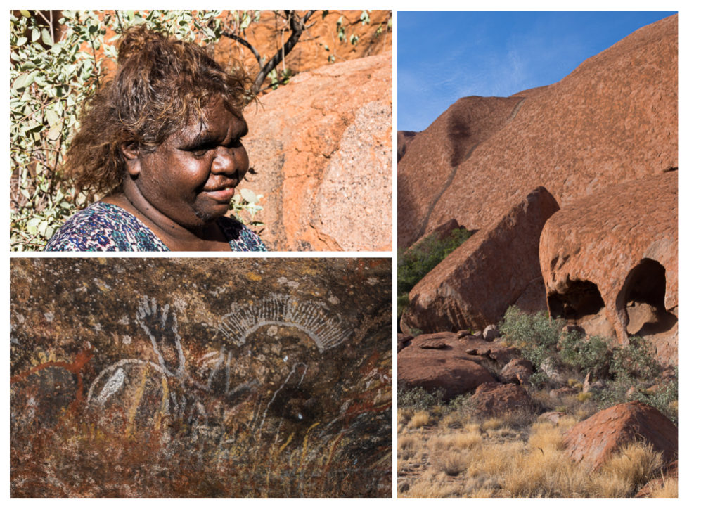
There are caves under the rock with cave paintings which were shown to us by an indigenous guide, Christine, who also explained how the Aboriginal people managed to live and hunt in the bush.
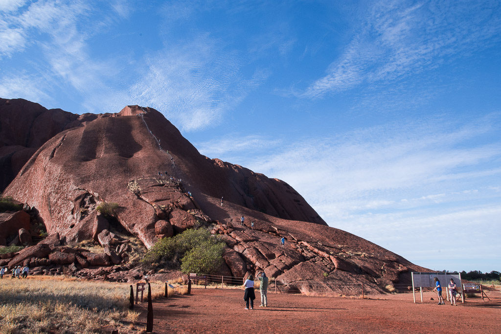
Whilst it is still possible to climb Uluru our tour company chooses not, respecting the beliefs and wishes of the Anangu people, and climbing will be completely banned from October this year. There were people climbing up the rocks with a handrail to help them.
Our second night was spent at a different campsite near to Kings Canyon, a three hour drive away through the National Park. The ‘desert’ which we had imagined to be just a barren wilderness is surprisingly green being in fact ‘arid zone’ with eucalyptus trees, shrubs and grassland. There are waterholes at the base of these huge rocky masses which dot the landscape and it started to become easier to imagine how people could survive in this hot, dry landscape where rainfall is so infrequent.
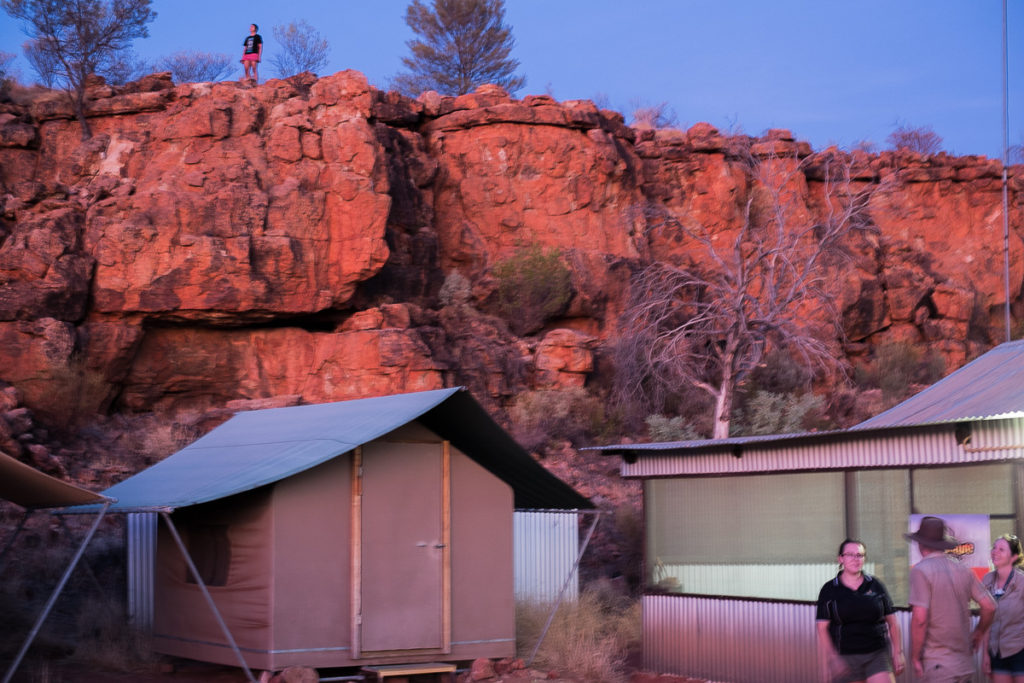
This night I slept outside in a swag which, with inbuilt foam mattress, was surprisingly warm and comfortable although I watched out for snakes on the way to the loos in the dark. One of the tour company had found and caught a large scorpion just outside the kitchen but that didn’t deter those keen to sleep in the open. When I woke in the night the sky was ablaze with the stars, the Milky Way and Southern Cross, and I was asleep again within minutes.
Another 5am start to Kings Canyon to do the 6km Rim Walk. We had been advised to carry 2 litres of water each and to drink regularly as in the dry heat, where humidity is just 6%, it is easy to become dehydrated. It was an initial steep climb with spectacular views from the top down into the gorge and over the surrounding landscape.
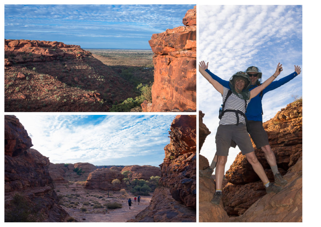
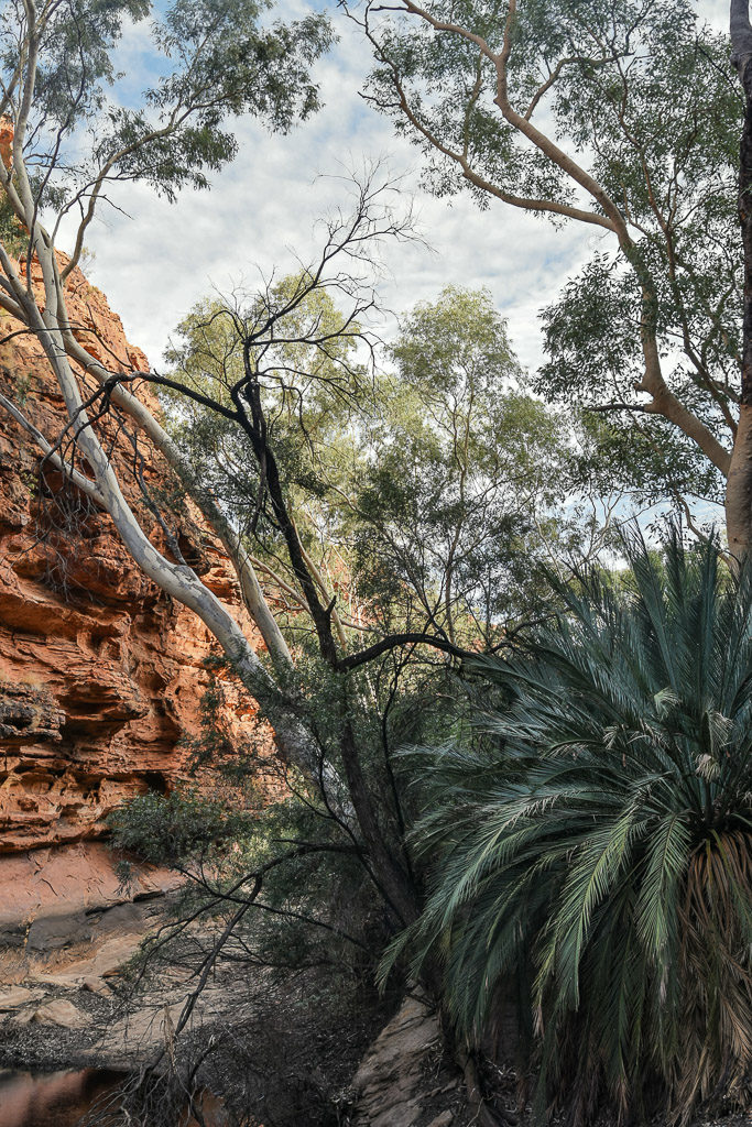
Within the gorge is a waterhole ‘the Garden of Eden’ where you are requested not to swim as it another place sacred to the local indigenous people. Again I was amazed by the trees and lush vegetation which grew here.
From here a 280 mile drive to Alice Springs and as we left the National Park the vegetation became more sparse with fewer trees and mile upon mile of fenced land enclosing massive cattle farms. From the road there are feral camels to be seen, descendants of the dromedaries brought over in the 1840’s to provide a hardy form of transport in the outback. There are thought to be around a million running wild and they are very destructive of trees and vegetation, so periodic culls are organised.
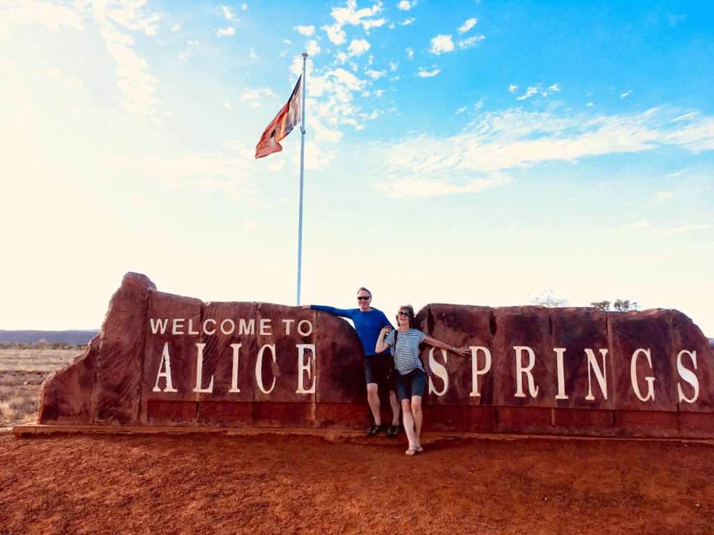
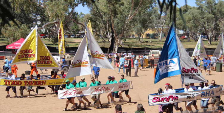
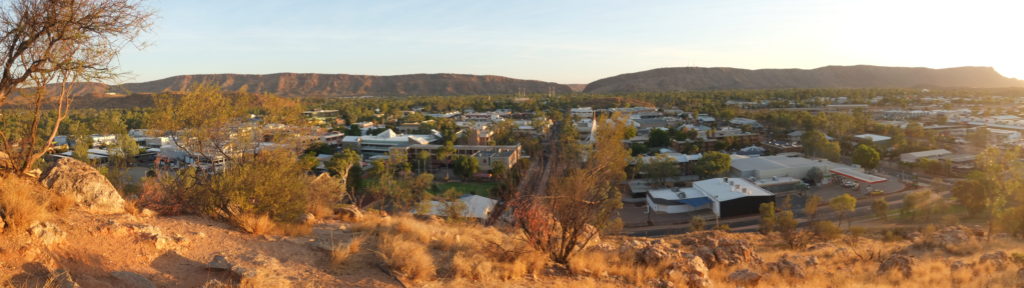
Our tour ended in Alice Springs, a town of about 24,000 people situated on the banks of the Todd River.
The Henley-on-Todd Regatta is held here annually with contestants racing along the dry river bed carrying bottomless boats. There are rowing, sailing and motorised categories but if it has rained recently and there is actually water in the river then the event has to be cancelled, which last happened in 1993. The Camel Cup, an annual camel racing festival, used also to take place in the dry bed of the Todd River but is now held on a purpose built camel race track. Sadly it was the wrong time of year for either of these exciting sporting events.
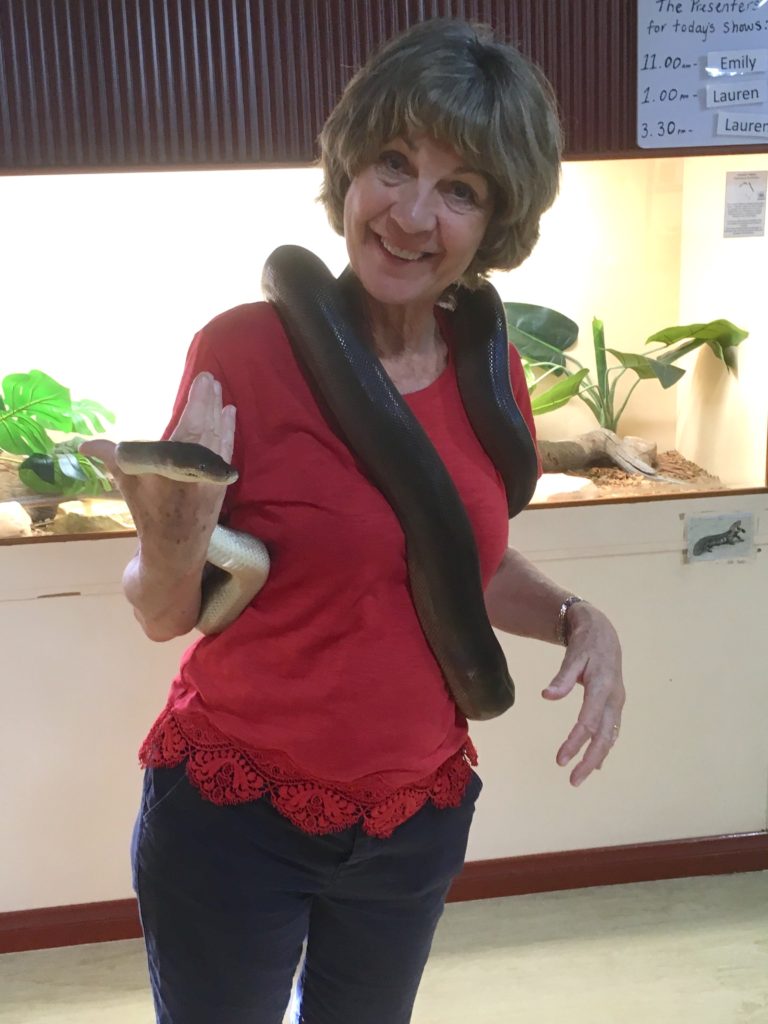
We had booked two nights at an Airbnb in Alice Springs so had time to visit the Reptile Centre there.
Interesting facts we learnt:
– Australia has 140 types of venomous snakes, amongst them the most venomous snakes in the world (there were specimens of some of these at the Reptile Centre, securely behind glass we were pleased to see).
– Deaths from snake bites in Australia are relatively rare as most snakes are shy and avoid humans.
– They have very short fangs compared with venomous snakes in India so if they bite you the venom is introduced into, and spreads by, the more superficial lymphatic system rather than the blood stream.
– If you are bitten by a snake apply a pressure immobilisation bandage immediately. It helps to slow down the movement of the venom in the body. Don’t make it too firm, it shouldn’t stop the blood flow. The bandage should be firm enough to compress the lymph vessels.
We went straight to the nearby pharmacy and bought a pressure immobilisation bandage.
We also visited the Royal Flying Doctor Service Museum and climbed Anzac Hill to watch the sun set over the town.
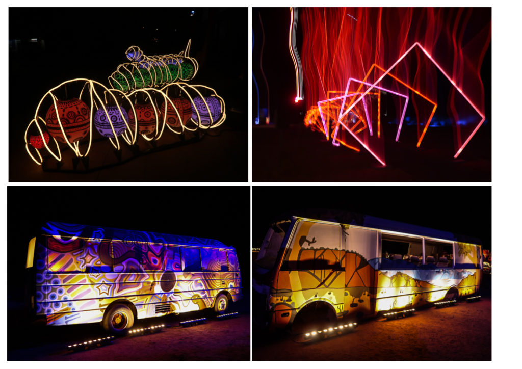
In the evening we caught a bus out to an Aboriginal light festival, Parrtjuma, with music and installations by indigenous artists plus an impressive light and sound show with multicoloured shapes and patterns projected onto a backdrop of the MacDonnell mountain range, accompanied by a booming narrative.
Our Airbnb host was concerned that we should get a taxi back and not walk around after dark. Alice Springs has been described as one of the most dangerous towns in Australia largely, it seems, due to the social problems suffered by many of the Aboriginal community.
To get back to Bundaberg involved three flights from Alice Springs, via Sydney and Brisbane. We were relieved to find that by the time we got back the temperature had dropped to the mid 20s C and it was no longer so humid. At the marina hopefully we could get the remaining jobs sorted and be off on our voyage up the east Queensland coast within a few days.
Thursday 11th to Monday 29th April – Marina Fever, again
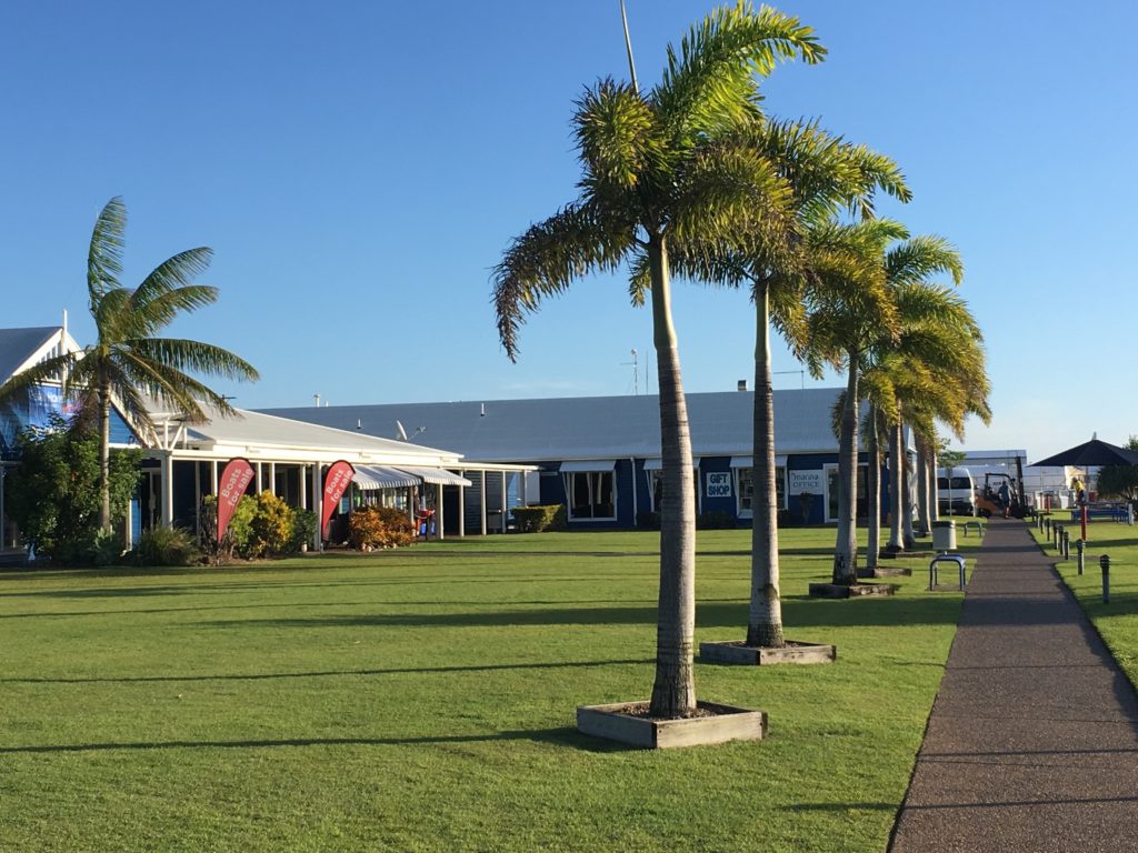
Marina Fever is a well recognised condition amongst the cruising community. Most cruisers prefer to be swinging gently at anchor in an isolated anchorage with only the dolphins, whales and seabirds for company. Well, maybe another yacht or two to share sundowners, perhaps a nearby village to get to meet the locals and a volcano, or at least a waterfall, to trek to. Marinas are considered unpleasant and expensive (most cruisers are on a tight budget) to be visited for vital repairs and haul-outs, for refuelling and the occasional stopover to facilitate reprovisioning. After two or three days in a marina yachties start displaying symptoms including lassitude, mild anxiety and irritability. Of course there are advantages such as ease of getting onto land, hot showers and the laundry (for those boats without washing machines on board ie. most small monohulls like us) and usually a bar or restaurant, but really any stay should be as short as possible.
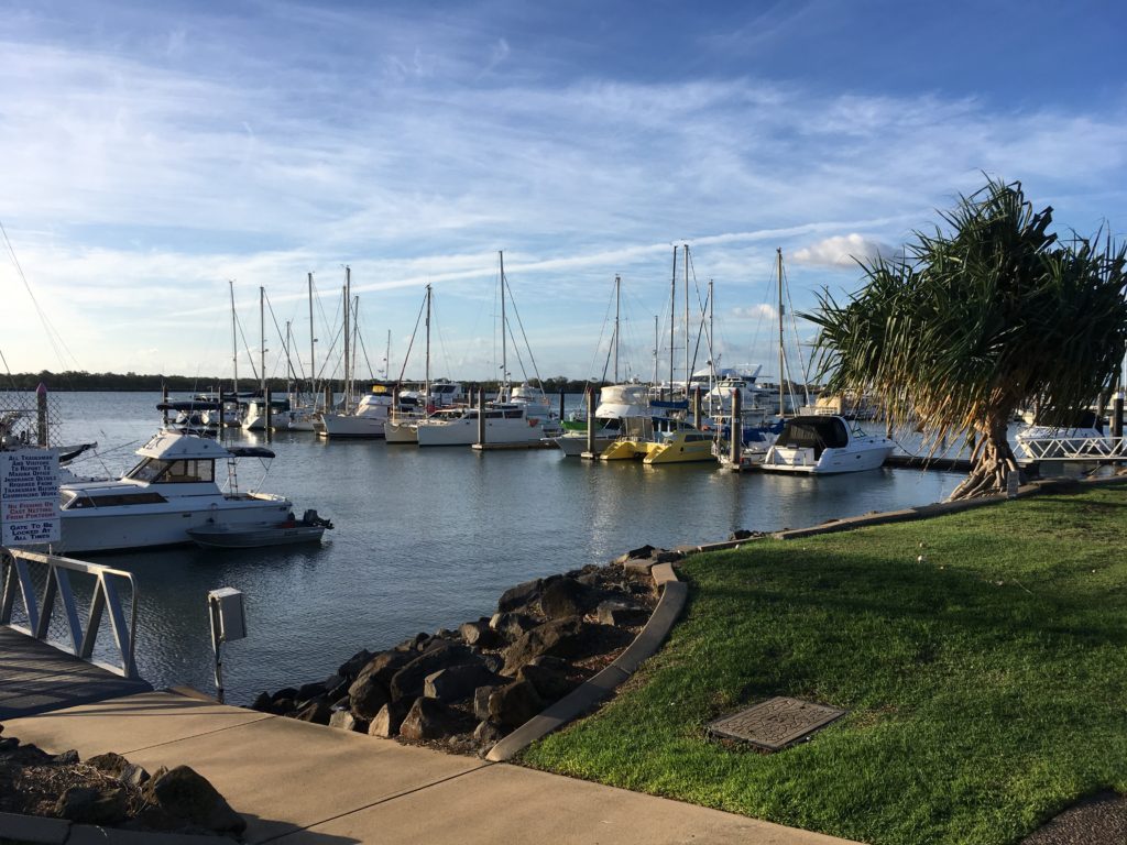
We had been in Bundaberg marina for over a month and were keen to get moving. Boats we knew that had spent the Australian summer south in Sydney were heading north this way and friends Matt and Amy on Florence arrived at the marina. We were having problems with the electrical system and Matt (an electrical engineer by profession) helped Hugh trace the fault and also went up the mast to check Vega’s rigging. We were just about ready and raring to go but the weather was not being cooperative. The wind was so strong and the swell so large that the day excursion boats based here had cancelled their trips to Lady Musgrave Island.
We used the time to try to get up to date on diaries and blogs, to sort the thousands of photos we’d taken of Uluru etc, to take trips into Bundaberg to visit the ALDI and Woolworth’s supermarkets to reprovision and we even bought new running shoes to improve our fitness levels.
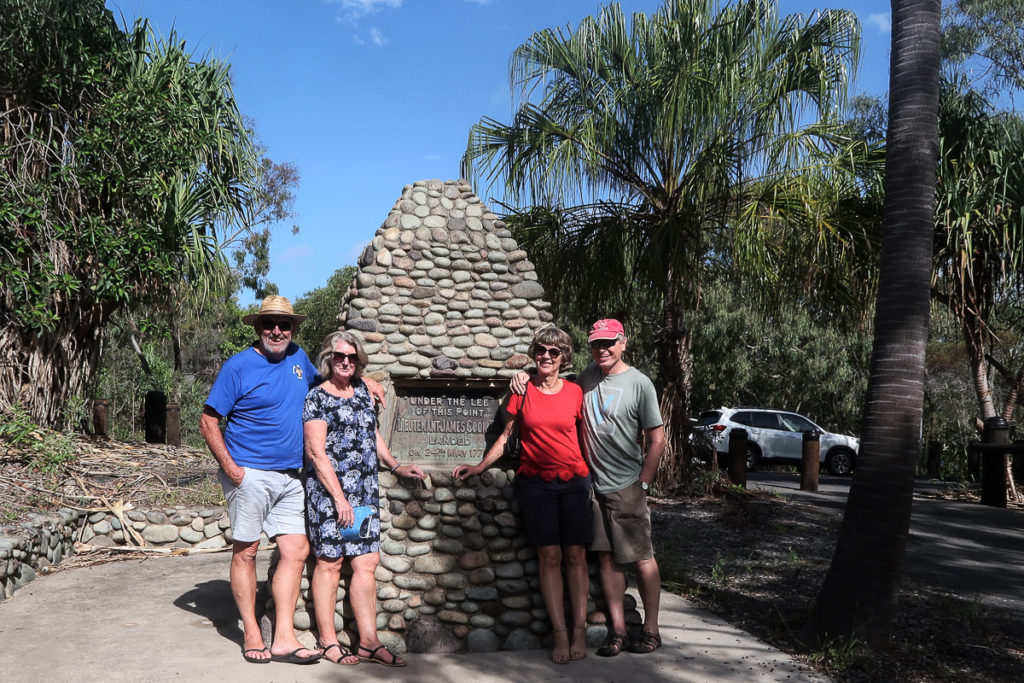
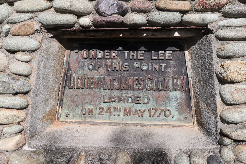
Australian friends Bob and Linda from catamaran Aquabar, who we’d first met last year in Vanuatu, visited and kindly took us for a drive north to the Town of Seventeen Seventy (named after the year that Captain Cook landed here).
Increasingly cruisers attended the regular Friday Cruisers BBQs and not just the Australian locals who live aboard here at the marina. We got our collapsible bikes out and cycled along the pretty and rugged coastline, past little beaches with lifeguards and surfers, to the small resort of Bargara, 15km away.
At the last minute one of the winches broke and Hugh spent another day taking this apart, fortunately finding replacement parts at the marina chandlery.
At last the weather forecast improved and after filling our tanks with diesel and water we finally said goodbye to marina life and left at 4am to sail the 50 miles to Lady Musgrave Island and the start of our exploration of the Great Barrier Reef and north.
7 Comments
Sam Lucas
June 1, 2019 - 6:16 amSounds like a great trip! I didn’t realise you were going to Tasmania, my girlfriend is from there and we could have given some tips. Looks like you made the most of it either way! I loved Mount Amos and cradle mountain!
annie
June 1, 2019 - 8:38 amHi Sam. We forgot … of course we should have asked you. But we had a fabulous time in Tassie anyway. Hope to see you when we’re back next xx
Steph
June 2, 2019 - 5:23 amGreat blog Annie, I’m thinking now we should sail to Tasmania! Safe travels xxx
annie
June 16, 2019 - 12:44 amThanks Steph… Tasmania would be wonderful to sail round if you are prepared to brave the Bass Strait xx
Amanda
June 2, 2019 - 3:07 pmLoving all your land based activities! Sounds like you are both having an amazing time xx
Anne D
August 11, 2019 - 8:10 amWhat a great trip. I’d love to visit Uluru…. feeling inspired!
annie
August 11, 2019 - 8:15 amThanks! Yes definitely an amazing place to visit x